Search This Blog

Blog Archive

Showing posts with label Loyalist settlement. Show all posts

Saturday, April 9, 2016

Hope Town, Elbow Cay

Road that bisects the length of the island from northwest to southeast.

I am writing from captivity in the Hope Town Harbour on Elbow Cay.  Quite literally, we are unable to leave except at high tide, which occurs twice each day.  We haven’t wanted to “escape” for the past several days, so you know we’re not suffering much in our “confinement.”
Harbor entrance:  Line boat up with street terminating at the water.

We were anchored off Tahiti Beach, three miles south of Hope Town when we heard someone announce there were vacant mooring balls in the harbor.  We jumped at the chance to get one of them.  There was heavy weather coming and our plan up until the very moment of that broadcast was to return to Marsh Harbour, a very large, well protected harbor some 15 miles away.  
Elbow Cay Lighthouse from within harbor

Hope Town harbor is quite small and there’s not enough room to swing at anchor, so mooring balls are the only option.  We’d met cruisers that had been waiting a month for a mooring ball to open up in the Hope Town harbor!  We pulled anchor and timed our arrival at the entrance to Hope Town Harbour to coincide with high tide, willingly choosing our captivity, at least one day at a time. 
Golf cart ride into Hope Town from Tahiti Beach

New friends gave us a ride into Hope Town only the day prior to acquiring a mooring ball inside.  People are nice like that here!  He picked us up in a golf cart from Tahiti Beach and drove us the 3 miles along the spine of the island to the northwestern part, where the Hope Town Settlement is located.   Charming little community of colorful buildings and extremely narrow little streets.
Wyannie Malone  Museum

Heavy weather rolled in over the course of the next two days, just as predicted.  Largely it was a succession of big blows but without much rain. The boat heeled far to port at times, and then far to starboard with extreme wind shifts.  It was an exhilarating time for someone like me, who enjoys experiencing the power of the wind…….from a safe and snug harbor, that is.   We enjoyed watching the wind whip up waves on the Atlantic beach side on our walks with Jax.  Awesome!
Jax met a new Border Collie bro'

Hope Town, like New Plymouth is a Loyalist settlement.  The residents found refuge here in the islands in the 1780’s during our American Revolution, which they apparently found abhorrent.   Why would anyone want to break away from the Monarchy, they must have thought.  The American history book writers refer to them as the Tories.  Here, however, history paints them as Loyalists.  It’s all about perspective.  
 ~100 residents died of cholera in the 1850's

The Bahamas did remain with the U.K.until 1973 when the U.K. no longer wanted to “own” the islands.  Many residents were quite unhappy about that development and pleaded to remain within the fold.  Alas, it was not to be.  
No vehicular traffic goes further without permit.   Jax plans to tell this golf cart they're much too noisy.

A wide gate remains closed across the little road leading into the oldest part of Hope Town.   It reminds drivers that there is no motorized traffic allowed beyond it.  The only exceptions are the very diminutive service vehicles and those with a permit to use a golf cart, owing perhaps to difficulty with ambulation, I surmise.  
Tiny little trucks.  Makes me smile.

Many of the buildings remain from the 1800’s.  Folks who build new construction are encouraged to build in keeping with the earlier architecture.  Many of those well kept little houses now are managed by real estate companies and rented by the week or month.  From our cockpit, we watch tourists arrive by ferry boat, pulling their travel cases on wheels as they head off on foot down one of the two tiny streets that follow the curve of the harbor, shaped much like a large inverted “C.” 
The extent of the Farmer's Market vegetables is displayed here.

We were eager to go to the Farmer’s Market on Saturday with the promise of fresh locally grown vegetables.  Expectations far exceeded the reality of the Farmer’s Market, however.   We could choose from a few types of greens, tomatoes, small bananas and cilantro.  Sigh.  All the cruisers filed into the little park area, anyway, to carry away the few fresh vegetables that were available—and glad to have them.
Elbow Cay Lighthouse

On the south side of the harbor stands the Elbow Cay Lighthouse, built by the British in the 1800’s.  The prospect of the lighthouse was one time when the Loyalists took issue with a decision by the Crown.  Their position was something like this….  "If a lighthouse warns ships away from the reefs, there will be fewer shipwrecks.   With fewer shipwrecks there will be fewer salvages and that will put a big dent in our wrecking business."   Salvaging or “wrecking” was a legitimate occupation for the Abaconians.   The folks of Hope Town (and perhaps surrounding islands too) sabotaged the building of the lighthouse in a variety of ways, but eventually the Crown won out and it was built.  
Fresnel lens.  Note kerosene lantern in the middle above.

We toured the Wyannie Malone Historical Museum yesterday.  I found myself wondering how many of the items on display were salvaged from ships torn apart on the reefs.  We found it to be a very interesting little museum, although presentation of the history of black residents of the Abacos was nearly nonexistent.  I’m hoping that will be rectified within the near future. 
"Lend a hand, or two?"

We’ve climbed the lighthouse twice.  First,  just to see it—the last remaining manually operated Fresnel lens lighthouse in the world.  The lighthouse keepers climb those steps every two hours all night long to rewind the mechanism.  They haul up kerosene hand over hand by use of a pulley and sisal rope through the center of the lighthouse.   
Last race of the season was quite distant.


The second time we climbed the lighthouse was to watch the last Hope Town Sailing Club sailboat race of the year.  We carried our binoculars up with us and enjoyed a great, albeit distant view of the race course.  All boaters were welcome to participate.  We couldn’t have raced our own boat even if we’d wanted to—we were trapped inside the harbor by virtue of low tide.  There are far worse places to be held “captive.”  
Gotta love old lighthouses.

We are, however, running low on vegetables and we’ll need to make a mad dash to Marsh Harbour on a high tide one of these days.  This may rank as the first time I’ve wanted to break free from paradise for want of a green salad.

Tuesday, April 5, 2016

The Golden Arc de Mirth

We meet people everywhere we go, even at the top of the lighthouse

Stories!  Oh, the wonderful stories we get to hear!  Meeting new people every day we hear stories told with accents from all over the world.  Among others, we have been entertained by the stories of an Englishman with a sharp wit and a clever tongue who unintentionally taught us a number of British slang words.  The only British slang that I previously knew how to use properly were ‘bloody hell’ and ‘bollocks’.  I cannot for the life of me, imagine why Americans opted out of maintaining these useful expressions.  Was it to slight those rebellious Loyalists?  Who knows?  
Oh, those Loyalists!

The most provincial phrase we learned was ‘Tickedy-boo’— now what do you suppose that means?   It is used to express absolute delight as near as I can figure.  The Englishman told us about the years that he and his wife spent sailing in Belize and the area of Honduras.  One of the characters in his story was ‘happy as Larry.’ I asked him who Larry was—he had no idea.  His story continued and involved a ‘quick nip’ —hmm……a rapid little trip down the stairs.  Daring to pursue a conversation about British and American politics. we heard him proclaim that “Well, we both have ‘nutters'.”  “Nutters?”  I asked.  People who are crazy.  Of course.  Perfect.  I’m going to make use of “nutters” from now on, reserving it for politicians, not the mentally ill.
The British are quite a humorous lot.  Who else would refer to the "Queen's Bottom"?

After the Cruiser’s Net reviews the weather, the condition of the cuts out onto the Atlantic, invitations to various restaurants, etc….eventually we get to the part of the hour where  cruisers are invited to announce their arrival or departure from this area of the Abacos.  We’ve been here for days already and not uttered a peep on the Net.  Finally, I couldn’t stand it any more—I went on the radio with my favorite radio personality in mind, Garrison Keillor.  “This is Northern Star.  We have actually been here in the harbor of Hope Town for a few days already, but we’re from Minnesota and so we’ve been reluctant to call attention to ourselves.”  A chuckle from the other end.  You see, the advantage of announcing oneself is that other bashful Minnesotans come out of the woodwork and we got to meet them and share stories with them as well.
Gifts from the Queen.  Fancy little things, aren't they?

One of the popular little stories that has begun to circulate in the harbor had its’ origin at our sailboat.  Every Monday, Wednesday and Friday morning from 8:30 to 9:30, the cruisers’ may bring their garbage to the dock for disposal.  A few of the nice sailors in the harbor take it upon themselves to buzz around in their dinghies and collect garbage from the other boats, thereby reducing the congestion from 20 or 30 dinghies going to the dock with garbage to only three or four dinghies.  Nice folks.  
One of the means of transportation in Hope Town

Last Friday morning the nice gentleman pulled up alongside our boat in his dinghy to chat with Carl briefly after taking our garbage on board.  Jax chose that moment to empty his bladder.  I believe I have mentioned in previous posts that Jax has become quite adept at his urination and elimination tasks onboard.  He very nonchalantly walked on deck, leaned against the cabin roof and peed off the side of the boat.  Apparently it was an impressive arc and it splashed squarely over the dinghy engine and onto the stern of the man’s dinghy.  Well, this was a bit of a surprise, as one might imagine.  Apparently, that had never happened to this man previously.  Why am I not surprised?
This Queen's Highway is less than 2 metres wide.


When the same nice man came by this morning to ask if we had garbage, Jax and I were both in the cockpit.  While laughing, he explained that he has made the story of the dog peeing off the sailboat and onto his dinghy his very own tale.  He told me, “I’ve gotten so much mileage out of that story, and retold it so many times.  I’ve embellished the story so much now that you wouldn’t even recognize it!”  I thought, ‘well, bully for you.’  Bully — another little British expression.  Handy, wasn’t it?
And God save the English wit.  

Monday, March 21, 2016

A Woefully Brief History of the Bahamas

It’s hard to explain to folks who have never looked at a map of The Bahamas (like me, for example, until a few months ago) where they are and that they are NOT part of the Caribbean Islands.  The Bahamian Islands do not lie within the Caribbean Sea.  However, that information eluded me until the last year prior to moving onto our sailboat when I began to take more notice of The Bahamas. 
Bordered by Florida to the west and Cuba to the south, lie the Bahamas. (map taken from The Cruising Guide to Abaco Bahamas 2016)

The Bahamas are a group of approximately 700 islands, our closest foreign neighbors off the coast of the eastern U.S.  Many of the islands are tiny, little more than rocks protruding from the water and those are uninhabited.  Many of them, thirty, are inhabited and have been so since about 400 A.D. 
Statue of a Lucayan, also referred to as the Taino,

The first known inhabitants of the islands we now call The Bahamas were the Lucayans, an Arawakan speaking group who were a very peaceful people living off the ocean’s harvest. They came from the land we now call Cuba.   
Pottery from era of Lucayan or Carib.

Some time later, they were invaded by a warlike people that sailed across the water from the south, perhaps from the area of Venezuela or thereabouts.  These invaders were called Caribs from which the word “cannibal” is derived. When the Caribs came, the Lucayans essentially disappeared, probably by the women being kidnapped and raped and by the murder and perhaps cannibalization of the men. There can be no darker moment in history for a people like the Lucayans who are now, no more.

One of the early maps, this one drawn by French navigators/explorers.

The next invaders were the Spaniards.  History books refer to them as the Conquistadores.  They came with their horses and armor and European diseases which in effect wiped out large populations of the natives, even before many of them had even seen a white person.  Columbus first landed on the island of Hispaniola (shared by the countries of Haiti and the Dominican Republic in 1492.  He established a church there to prove to Queen Isabella who funded his ventures that he was establishing a Christian settlement there.  For good measure, he abducted a few natives to bring back with him to Europe to prove his point. Columbus referred to the area as "the baja mar" (Spanish pro. 'ba'ha mar') which means shallow sea and the name stuck -- The Bahamas.  
The Bahamas population is about 330,000.  Most Bahamians are of West African descent.  Many Haitians have migrated to the Bahamas as well, over the past few decades. 

By the 1600’s, the Spaniards were spreading over many of the islands of the Caribbean and into some of the islands of The Bahamas.  Naturally, the white settlers goal was to establish commerce on the islands and if they could find gold or a fountain of youth while doing it, so much the better.  Commerce required slaves, as it turned out, and for a couple hundred years, the Spaniards (and folks from other enterprising European countries as well) bought or stole hundreds of thousands of black slaves from the African continent to the Caribbean Islands and into The Bahamas as well.
Bahamian teens swimming off the dock in Marsh Harbour on a warm Saturday in March, 2016.

Commerce included attempts at growing crops like pineapples, coconut and sugar cane—all crops that required hard labor in extreme heat.  The white entrepreneurs believed that the slaves were more resilient to the heat than their white counterparts and found that they were immune to some of the diseases that came along with the mosquitoes which were inadvertently imported from Africa as well.  White soldiers, property owners, businessmen and priests died by the thousands, while the people stolen from the African continent died in proportionately smaller numbers, but there were so many slaves brought into these islands that their numbers continued to increase, regardless.  
Gravestones resemble early New England/English markers.  Graves appear to be more hallow however.

With the search for religious freedom as the impetus, a group of English Puritans settled in The Bahamas along about 1649.  They may have found that, but they also found they did not have enough to eat.  The Massachusetts Bay Colony actually helped them out with a shipload of food and the Bahama Puritans repaid the Colony with brasileto wood.  It must have fetched a handsome price because Massachusetts used that money to put toward land for a school, Harvard.
Stories abound about pirates hiding their treasure around the islands.

It must have been easy pickins to be a pirate in the Bahamas in the 1600 and 1700's.  Shipping lanes to the American colonies were nearby.  With its' shallow water and reefs that snatched unsuspecting ships loaded with booty,  
Statue commemorating the Loyalists who fled to the Bahamas.  New Plymouth, Green Turtle Cay, Abacos, Bahamas. 

Another group of invaders came into the Bahamas much later, in the 1780's.  Those were the Loyalists to the British Crown.  While the American Revolution was in full swing in New England, the Loyalists escaped to The Bahamas, many with only the clothes on their backs.  Those Loyalist communities on some of the Bahamian Islands still resemble the New England villages that they fled.  
Princess Margaret.  The Bahamas were a British colony until 1973.    

The descendants of those Loyalists are still here in the islands.  They are of English, Scottish and Irish heritage.  They tend  therefore, to have blonde or reddish hair, blue eyes and fair skin.  They have names like Lowe, Curry and Roberts.  When they speak, their Bahamian accents lead me to ask for repetition as often as I do for any Bahamian of color.   Linguistically speaking, this is an interesting place, and I would like to learn more about that—a 200 year old English speaking population that has stirred up that language with folks of African heritage in communities isolated from the influence of any major populations, at least until more recently.  It’s unlike any spoken language I have previously heard.  When two Bahamians are speaking to each other, it may be virtually impossible for me to glean even the topic of their conversation.   
The Bahamas are an independent member of the British Commonwealth.


To further confuse the reader, the Bahamas are divided into different groups of islands.  The northernmost group of islands closest to the U.S. are the Abacos.   The Abacos’ largest islands are Grand Bahama Island, Great Abaco Island and Andros.  None of them are heavily populated. 
Pineapple coconut jam.  Coconut grows naturally. 

Nassau, the capital of the Bahamas is on the tiny island of New Providence.  The Bahamas also includes the Bimini Islands, the Berry Islands, and the long string of little reef islands that border the Atlantic which we have begun to visit beginning with Green Turtle Cay, Manjack Cay and now Guana Cay.  Further southeast are Man o' War, Elbow Cay, Eleuthera, then the Exumas, followed by the Turks and Caicos.  By the time one has passed through the Caicos, you may safely say you are in the Caribbean.  The Caribbean is yet another 7000 islands representing 28 different countries.  Fascinating stuff, huh?
The Bahamas extend about 550 miles across the waters north of Cuba and east toward Hispaniola. 

Tuesday, March 15, 2016

Visitors to Green Turtle Cay

International arrival at Marsh Harbor airport

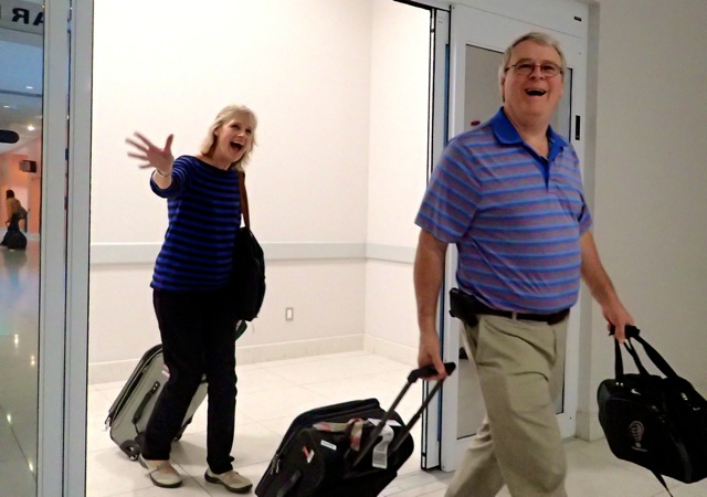
At last we had our first visitors in the Bahamas.  It was marvelous!  There have been relatively few visitors to Northern Star since we moved aboard last April, and until now, visitors were all while in the U.S.  Perhaps then you can understand our excitement at traveling to Marsh Harbor to pick up our guests from Memphis, TN.  
Carl's sister at Treasure Cay

My husband’s sister and her husband arrived last Tuesday noon and departed again via Marsh Harbor Intl. Airport on Saturday.  It was our (okay, more my) goal to pack as much Bahama life into those days as possible.  My husband reminded me that we had to allow them time to do what they wanted to do, too.  “Ya, ya, okay, okay,” I said.

Walking beaches of Green Turtle Cay
From the Marsh Harbor Airport we drove to Treasure Cay where we had a beautiful lunch on the beach.  Then, we rode the ferry to Green Turtle Cay, crossing the Sea of Abaco from Great Abaco Island.  The aqua water does not disappoint any visitors to the Bahamas, I’m sure.  

First time driving a golf cart
We walked the beaches both along the ocean and the bays on Green Turtle Cay.   A golf cart helped us cover a lot more ground that we might have done on foot, or in our dinghy.  Theoretically, we could take four people in our dinghy, but I might not want to be one of them.  Just sayin’.  There were strong winds for their visit.  With four in a dinghy, we’d have been riding low in the water, and would have been drenched.  Although we’ve become used to getting sprayed on wet dinghy rides its probably not the best way to entertain one’s new guests to the Bahamas. 
Bronze Sculpture Garden

We were pleased to show off  “our” little town, New Plymouth, the settlement on Green Turtle Cay.    Our guests enjoyed the Albert Lowe Museum, which is housed in an 1826 house and explains the history of Green Turtle Cay in the Abacos.  The Loyalist Statue Garden was a must, as well.  And the cemetery; I always think a walk through a cemetery has much to say about the history of a community.   Bahamians, similar to the Americans, tend to care for the gravestones of loved ones, and mark the places on the island where deaths have occurred.   A delightful lunch on the beach at Harvey’s followed.
Lunch at Harvey's on the shore

Our guests stayed at the Bluff House Marina and resort in a lovely second floor room overlooking sunsets over the Sea of Abaco.   The remark was made that the scene was a “1940’s postcard of the Bahamas.”  Ya, I think we’ve all seen that postcard. 
Sunset from Bluff House

The major event of the week was an “Adventure Day” with Brendal’s Dive and Watersports.  Brendal is a well-known waterman in the Bahamas, bringing people out to snorkel, scuba dive, learn how to spear lobster, and can teach folks how to sail too.   Just about anything that takes place on or under the water Brendal can do with ease.  The Wall of Fame in his dive shop includes names such as Pierre Trudeau, the Discovery Channel and the Food Network.  He is quite an amazing character.  Complete with an incorrigible sense of humor. 
Brendal's Dive Center boat.  The manta rays met us here.

The four of us met at 9:00 at the Dive shop and three of us were outfitted with wetsuits and snorkel gear.  Carl’s  sister opted to watch us from the boat.  Carl and I had recently purchased our own snorkel equipment which we were eager to initiate.  We each also wore a small buoyancy vest.  
Snorkeling is so easy with wetsuit and buoyancy vest.

There were six paying customers, along with Brendal and two helpers onboard.  Because the winds were still rather strong, the water on the ocean reefs was a bit dicey.  Therefore, rather than the reefs, we snorkeled on a shipwreckThis day was spectacular and I am now determined to snorkel every chance I get.   The plentiful fish on the wreck were gregarious.  The more rare specimens were shy and required a bit of patience for their appearance. 
 
One of the shy fish
While we were snorkeling, Brendal and one of the helpers swam up along the shore looking for indentations in the shoreline that were suspicious for housing lobsters.  They speared a few to add to the ones that he had brought with him, just in case.  Brendal made some lunch preparations on board—then took us to a pristine beach where his helpers showed us how to feed manta rays pieces of fish from between our toes.  
Manta rays waiting for their fish from our toes

The rays were waiting for us — apparently they have an ongoing relationship with Brendal.  One of them he calls “Tony.”  The rays swam back and forth vacuuming the tops of our feet for the chunks of fish.  With a bit of practice, we were able to feed them the fish from between our fingers too.  Did you know that manta rays like their underbellies scratched; I was reminded of our dog, Jax.  We were told that later in the day, the really huge rays would make an appearance.  Amazing creatures!  Simply amazing!
Snapper in the big pot and butter sauce

While we were shrieking and flirting with the notion that the manta rays could nip our toes, Brendal built a tiny fire and cooked our lobster and fresh mutton snapper in a big old Dutch oven over a few sticks the two men had gathered.  A wonderfully aromatic butter and citrus sauce bubbled on the crude grate as well.  
Bendal preparing the salad on the beach

We had as much lobster as we could possibly eat, the snapper, salad and coconut bread; and of course, the ubiquitous rum punch.  Mmmmmm.   Could the day have been any better?  Maybe, but I don’t know how.
All the lobster we could eat.  I had three!