Search This Blog

Blog Archive

Showing posts with label Gulf Stream. Show all posts

Sunday, April 14, 2019

"Hey, You're Going the Wrong Way!"


Isla Saona, off the southeast corner of the DR. A beautiful national park.

Geography can be hard. The largest land masses, the seven continents of North and South America, Africa, Europe, Asia, Australia and Antarctica……I had all of those solidly nailed down by the 6th grade thanks to our American public education system. 

I gave in to the teaching that Europe and Asia are considered two continents when in fact, they look pretty darn much like one huge land mass to me. Hmph. Go figure. And who got to decide that Australia was a continent but Greenland was too small to make the cut? Was there a vote? If so, Greenland and some other island nations needed better representation, but I digress. 

Puerto Bahía Marina, Samaná Peninsula, DR
Frankly, until only a few years ago, I was quite content to live my life without giving the smaller chunks of land sticking up out of the oceans any thought whatsoever. All of those thousands of smaller lands, the islands— their very existence occupied an embarrassingly small amount of gray matter in my head. 
Far from our usual marina experience, this is the most
elegant marina we have ever seen.  Inexpensive, too.

I confess this now only to put the readership at ease.  If for example, you have ever been one to surreptitiously dig out an atlas (or to Google) to see where we were while in Trinidad, Grenada, Bonaire, Curacao and now the Dominican Republic, as far as I am concerned, that  is no cause for shame. 
The town of Samaná, on the northeast side of the DR. Home of the Bridge to Nowhere.

Up until a month ago, we had no intention of being in the Dominican Republic right now. Why? Because it’s way north of Bonaire. And when we were in Bonaire, we were really pretty close to South America. Our plans (written in sand, as my husband is wont to say) were to sail to Colombia after the winds settled a bit, later on in April/May.  
Riding a 4 passenger motorized bike

From Colombia, we were to go on to the San Blas Islands (off the eastern Panamanian coast), then to Panama proper and perhaps further north in Central America for the hurricane season where we would have left the boat for a visit back to the U.S.
Our driver, a real ham. Made ambulance
siren sounds much of the way to the
Bridge to Nowhere.

I don’t know whether anybody else has had this thought, but one of our FB friends commented the other day, “Hey, you’re going the wrong way!” Now that guy knows his geography. Indeed, we have moved away from South America and toward the U.S.
Bridge to Nowhere--a resort project that
was abandoned.

For a variety of reasons, we decided that we were not inclined to sail on to Colombia and Central America at this time. Many of our sailing friends have already sailed there and onward. We love seeing FB reports of where they are and what they are doing. We would certainly have enjoyed sailing with them there, but that didn’t happen at the right time.  About a month ago, we looked around and realized that nobody had a gun to our heads saying “You MUST sail on to Colombia from Bonaire” and so we just decided not to.

At the far end of the Bridge to Nowhere
Call us whimsical; call us changeable, tumbleweeds blowin’ in the wind, or simply sailboat vagabonds, but we are heading back to the East Coast of the U.S. for the hurricane season. As you may recall from previous posts, our marine insurance policy requires that we remove our boat from the hurricane zone between June 1 and November 1. 
Paintings sold at the base of bridge

If Northern Star were to remain in the heart of the hurricane zone and was then damaged in a hurricane, she would not be insured. So, our options from Bonaire were: 1) go on to the coast of Central America, 2) return to Trinidad {below 10 degrees latitude N} or 3) move the boat above the Florida/Georgia border. We chose #3. (You and I know that hurricanes hit the U.S. coast north of the Florida/Georgia border as well, but the boat insurers came up with this arbitrary line on the map, so….there you have it. Somebody voted on the geography again).

My first piña colada served
in a pineapple
We still have ~2000 kilometers, or 1079 nautical miles, or 1242 statute miles to get from our current location in Samaná, DR to the Florida/Georgia border. We will bypass about 700 islands (no exaggeration) before then. We will go through the Turks and Caicos, the Exumas and the Ragged Islands and finally the Abacos. We’ll stop at a few of them to explore, rest and to snorkel. 
The Dominican Republic lies east of Cuba and is not pictured above.
All of the above islands are part of the Commonwealth of the Bahamas which is scattered over an area of 100,000 square miles of ocean. Most of these islands are so small that you may have difficulty finding them on a map. And this might be a brain bender for some—the Bahamas are not part of the Caribbean. What? Yes, it's true. The Bahamas are not on the Caribbean Sea. They are in the Atlantic Ocean. See, it’s that geography stuff again. Geography can be hard.

Saturday, November 4, 2017

Countdown to Set Sail

Salty Dawg Rally boat leaving Bluewater Yachting Center

A large percentage of the Salty Dawg Rally boats left as planned, on November 2nd.  We did not, however.  Our decision-making was influenced by the fact that we were still in need of one prescription medication AND a box of supplies before departure.  Leaving without those things would have brought about other problems down the road, and so we waited.  It also appeared to us that we would have better wind for sailing and possibly less motoring if we left a couple days later.
from L to R: Carl, Harry, Luke, Finola (Harry's wife) and me, Ardys

Our departure date is now set for today, Saturday, November 4th.  We are not unhappy about this as there was very little wind in this part of the Atlantic on Thursday.  The boats that left then are largely motoring. Many will have to make a side stop in Bermuda to fill up with fuel before finishing the passage to Antigua.

Our friend, Dale removing dock lines from the piling before departure
Departure today will mean a little more wind for sailing and we are happy about that.  It’s been a very long time since I have sailed on Northern Star, in fact, not since the beginning of April.  I enjoyed photographing some of the boats during their final preparations on Thursday morning and watching them leave the dock.  We will catch up with them later, in Antigua.  

Fin won 2nd prize for her Halloween costume
People who are interested in following our journey will be able to track our course via our inReach satellite system. Go to:  https://share.delorme.com/NorthernStar. You will see our location on a map of the Atlantic and the location will be updated every 15 minutes, give or take.  Because the ocean is so huge and we are so small, it may appear as though we are barely moving. Do not be alarmed—we will definitely be moving—somewhere between 4 1/2 and 7 1/2 knots from departure until we reach Antigua.  
Honorable Mention for McGruff's Halloween costume 

Our inReach will also allow us to send short text messages to our families from the ocean, as well as to receive texts from them.  
Rhumb line from Hatteras to Antigua

The photograph shows a “blank” map of the Atlantic where we have marked our rhumb line.  The rhumb line is the most direct route from our current position to Antigua.  It is not our anticipated route however. Leaving Hampton, we will first go southeast toward Hatteras to avoid running into the counter-clockwise eddy on the eastern edge of the Gulf Stream.  From Hatteras, we will push hard to get as far east as we can before turning south toward Antigua.  
A Rally boat with 9 diesel jugs.  Northern Star holds 125 gal diesel

Why do I say, “we will push hard to get east?” This is because of those pesky Trade Winds that flow just north of the Caribbean.  Once we get into them, they will push the boat back toward the U.S. Thus, we want to get in as much easting as possible, before turning south. Once every 24 hours, we will mark our exact Latitude and Longitude (LatLong) on our paper map. (The paper map will make a memento of our passage). Other than that one daily event with our paper map, our electronic charts and compass will be used exclusively.
Topping off water before departure

The sailors have a saying about this course.  “Head east until the butter melts (in other words, until the winds and seas are warmer, along the 65th parallel) and then turn south.”  This strategy will take us much closer to Bermuda than one might think would be necessary.  But that will help us avoid having to motor straight into the Trade Winds later.  
Nice fishing pole for trolling on passage.

Carl and Harry have set our waypoints on the chart plotter which will guide whoever is on watch and monitoring the autopilot.  Our autopilot will do the bulk of the steering for us. Our crew of four plan to follow a 3-hour watch schedule round the clock.  Thus, each of us will be on watch twice/day for a total of 6 hours.  The rest of the time, we can sleep, prepare meals, read, or whatever else needs doing.  Anytime the weather requires a change in the sails, two of us will be required for that.  The person that was on watch during the previous 3 hour period will be called into service for a sail change. 
Find the toys: paddle board against starboard lifelines. Two bicycles lashed to the mast.
Throughout the passage, we will be in contact with other boats in the Rally by way of our SSB radio (Single Side-Band) twice/day, at 0700 and 1800.  Each boat will call in their position to the Rally. If there is an urgent need for a boat to be contacted, the Rally can call us on SSB and contact us on our inReach. We will monitor Ch.16 on our VHF at all times. 
Checking to be sure our ditch bag floats.  It DOES!

We also have the assistance of our weather router, Chris Parker, who broadcasts wind direction, currents, and sea state specific to any LatLong that we need.  He specifically is working with all of the Salty Dawg Rally boats as we travel to Bermuda, Antigua or Bahamas.  His input is what helps us figure out our heading, and decide where to enter and exit the Gulf Stream.  The Gulf Stream is about 100 miles wide off of Cape Hatteras which is where we will enter the Stream. As you know, the Stream will push us north as we cross it and we don’t want to get caught up in that counter-clockwise eddy on the other side of the Stream.
Fin helped me with my third and last major provisioning run.

Carl and I will maintain our same phones in the Caribbean.  We will use them primarily for texting family and friends.  Talking to folks in the U.S. will be extremely expensive. We will continue to be available by email while in the Caribbean. 

FYI: While all you landlubbers will be going on Daylight Savings Time soon, we will not.  The Caribbean remains on Atlantic Std Time. 


Our crew for the Rally to Antigua.  Carl and I on boat. L-Luke.  R-Harry.
Our crew is in place and we are pumped!  We are leaving the dock this afternoon in order to enter the enormous St. James River during the ebbing tide. That will help push us out onto the Atlantic about 12 miles from here.  The four of us, Harry, Luke, Carl and I, are ready to go sailing!  Woo-HOOOO!

Sunday, April 24, 2016

The Dolphins' Dance: A Gulf Stream Crossing

Sailing across Little Bahama Bank

It was our intent to travel as far north up the U.S. East Coast as possible when we left the Bahamas.  That is, as far north as our weather window would allow, before landing on U.S. soil.  In preparation, we traveled to the north end of the Sea of Abaco and positioned ourselves off a tiny island called Great Sale Cay on the Little Bahama Bank.  It was a long day’s sail to reach that point but once there, we were ready for the good weather window as predicted.  
Leaving Great Sale Cay.  Only three boats left here out of ~30.

Thirty boats, give or take, were already at Great Sale Cay when we arrived there Monday evening.  By early next morning, the pack had started to thin.  The wind was good and the sailboats were heading north for the U.S. and Canada.  We needed just a bit of time to rest however.  
Little Bahama Bank is not little.   An area of approx. 160 square miles.

By the time we were ready to depart Tuesday afternoon, the winds had died significantly.  Sailing was “okay” for a while, but then we were obligated to resort to the “iron jenny”” once again—a sailor’s reference to running the engine because the sail (genoa, or “jenny”) was not adequate to make headway.  Carl had calculated that if we traveled at an average of 6 knots the entire way, we would make Charleston, S.C. in 63 hours.  Sixty three hours from Great Sale Cay, that is.  
Might as well make cookies on calm passage.

Sigh.  Apparently, our weather window was “too” good.  We had so little wind that we had to motor much of the way.  We kept our mains’l up which helped to stabilize the boat’s rocking, but often times, did not help us much for speed.  
Late afternoon with rain approaching.

Because we were using more fuel than wind to make it across the Gulf Stream, we decided to abandon the goal of Charleston, and instead headed toward landfall at Fernandina Beach, Florida.   We arrived today, a trip of 48 hours.  As luck would have it, just as we left the ocean and entered the channel leading to the St. Mary’s River at Fernandina Beach, the wind that we had so hoped for during our Gulf Stream crossing, arrived at last.  Aughhh.   
Approaching the Gulf Stream at sunset.  

Two other sailboats departed Great Sale Cay at about the same time we did.  As is common practice, the boats were in contact with one another during the passage.  The boats introduce themselves to one another by VHF radio, share our respective planned destinations and blatantly admit our appreciation for the presence of the others out there, three little boats on a big ocean, separated by a few miles of Atlantic.  At night, we could see two steaming lights on the horizon.  Four other people, just like us, out on the Atlantic, heading in the same direction.  There’s something reassuring about that.  
Clouds and moonlight on the ocean.

We set our course for the middle of the Gulf Stream, just where Chris Parker, our weather router had said it would be—at Lat 29 N, and Long 079.45 W, and once in it, had quite a ride.  We enjoyed speeds of 10 to 11 knots for several hours heading north mid-Gulf Stream.  That in spite of very little wind.  
Pair of dolphins with one directly below the other.
The most memorable part of the Crossing however, was the complimentary dolphin escorts both Tuesday and Wednesday evenings just before sunset.  

Two to four dolphins would lead just ahead of our bow.
On Tuesday evening, we were still on the Little Bahama Bank with water only 18 to 22 feet deep.  Suddenly, there were dolphins surrounding us, swimming parallel with the boat and seemingly eager to lead us onward.  They raced for the bow of the boat where they took turns being in the lead, one after another showing us the way forward, while the others of them feinted to the left and to the right, leaving another of their entourage to be the point man at the bow.  
Dolphins taking turns at the bow.  These two will go around to the stern and then return to the bow for another turn as lead.

They played in this manner with our sailboat for twenty minutes or more, as the sun closed the distance to the horizon.  And then they were gone.
These two are next "in line" to lead the vessel forward.
Wednesday late afternoon, mid Gulf Stream, thousands of feet of water beneath us, there they were again….not the same dolphins, of course, but a whole new squadron of them.  They surrounded the boat, while other newer recruits came flying and leaping through the water from behind to catch up.  

Three, four, five... up to six dolphins would join us at a time.
Another group came from the west, all of them eager to be part of the choreography.  Some sort of communication between them must provide them with the rules of the play—the prime directive, no doubt, being to escort our big, slow vessel toward the west while demonstrating the dolphins’ obvious superior skills.  
The dolphins really seem to enjoy the role of escorting Northern Star
Our boat was no competition for the dolphin’s ability to slice cleanly through the water, to leap and twist out of the water, and in synchronized fashion, to maneuver up, down and alongside their companions.  It was a well-rehearsed dance wherein each knew what the other’s next move would be.  
I began to recognize some of the dolphins as they took turns.

As if carefully choreographed, two or three dolphins would take the lead below our bow, then one by one peel off to the rear, so that another two or three could take their turn at the bow.  An egalitarian equal-opportunity set of rules which they played perfectly.   Good friends will play that role for you as well. 
Young dolphins playing in the water near one of our anchorages on the Sea of Abaco.


Tuesday, February 16, 2016

16 Hours to Great Sale Cay

Palm Beach to port
Our long awaited weather window having arrived, we were eager to get across the Gulf Stream.  We arrived at our desired departure location the night before, the port of Palm Springs located at the Lake Worth inlet from the Atlantic Ocean. We had provisioned THREE times awaiting our “window.”  Each time we added more to our store of items that we knew were going to be either extremely expensive OR perhaps impossible to get in the Bahamas; the biggest three on our list being all paper products, American beer and cuts of beef.  We had 140 gallons of potable water in our tanks and another 10 gals in two blue jugs, reasoning that if our tanks ran dry, we would have that buffer to hold us over until we could find a place to fill up again.   We were aware that we would be paying for water in the Bahamas.  Our diesel tanks were full and our holding tank empty. 
NORTHERN STAR on Little Bahama Bank

The night before departure, we tackled the last minute details…everything that could be secured behind doors or within bungees was secured and locked.  Carl attached the jacklines* to the port and starboard sides of the boat.  We dug out the tethers that attach to our sailing harnesses for humans and canine alike. The dinghy was firmly tied down and chained to the davits and the stern of the boat.  There were multiple sandwiches made, so that I wouldn’t have to spend much time in the galley on the crossing.  Carl plotted our course on the iPad which was then uploaded to our chart plotter.  “Data” (the name we had chosen for our autopilot) would be following that course whenever there was no human at the helm.  Carl filed our float plan** with a sister and one of our children.  We were ready to cross.

Sailboat on the horizon.
We raised anchor at 0400 and headed out through the Lake Worth inlet.  By VHF we knew there were three other sailboats departing from the inlet at about the same time—S/V Nemo behind us, S/V Cross Winds to our port side and S/V Celine (sp?) ahead by a couple of miles.  We could see the lights of all three sailboats and talked with them briefly, acknowledging the presence of each and traded our planned destinations.   It was a bit of comforting camaraderie in the darkness.  The winds were very light and the seas had some left over rolling swell from the previous heavy winds. We proceeded under power alone initially.
Sailing at last!

As the sky began to lighten ahead of us, the wind picked up just a bit, between 9 and 13 knots, so that we were able to raise the main with some effect on our speed.  We anticipated a very long day on the water and determined that whether by sail or by motor, we would try to maintain a speed of 6 to 7 knots in order to reach our intended evening anchorage within a reasonable time frame.  

Water temp reached 74.4 mid Gulf Stream
I found it fascinating to watch the water temperature rising as we entered the Gulf Stream, knowing that the water was the deepest there between the U.S. coast and Bahamas, and yet the warmth of the Gulf was pushing north beneath us. 
Astonishingly aqua blue water on Little Bahama Bank

After several hours, some distance ahead of us, perhaps a 1/2 mile or more, we could see a horizontal line of bright aqua water, the Little Bahama Bank.  On the charts, it is identified as an enormous body of shallow water, 12 to 28 feet deep.   In person, it is a brilliant shade of blue punctuated by swaths of deeper blue green which are floating or submerged grasses.  Being able to see the bottom nearly all of the time on the Bank is astounding!  
Jax refreshed after water and a few trips around the deck. 

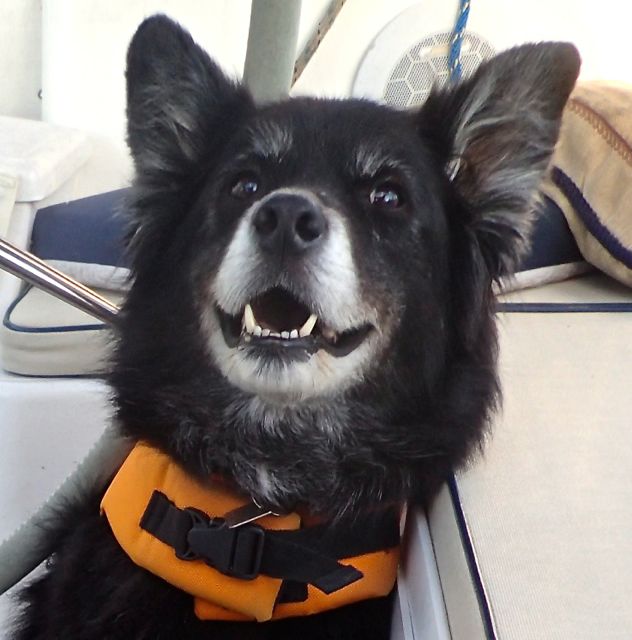
As is customary for Jax, he wore his life jacket throughout the ocean passage, although he showed very little interest in going up on deck to do his “business.”   When the seas roll, he prefers to stay low in the boat, close to our feet.  He is not interested in food or water.  We can only assume his tummy feels a bit “off”.  We gave him small ginger doggie treats to help with that at the outset.  
Utterly silent seas.

As the seas continued to flatten, Jax seemed to be more and more contented although until we shut off the engine and sat still in the water for a bit, he would not drink, nor empty his bladder.  Therefore, later in the afternoon, we picked a spot somewhere on the Little Bahama Bank and just sat in total silence for several minutes.  The quiet and calm was rejuvenating.  Meanwhile, Jax drank lots of water, made his rounds on deck and then we were off once again.  
Sunset behind us

Crossing the Banks the waters become nearly flat by the end of the day’s voyage and the winds all but nonexistent.   We followed our course as planned, which took us to the southwest side of a small inverted J shaped island, called Great Sale Cay (pro. “key) where we put down our anchor in 12’ of water.   Beyond us were the lights of 5 other sailboats and one trawler, similarly at rest on the water for the evening.  We were in the Bahamas at last.

The first of many stunning sunsets in the Bahamas.
*Jacklines—sturdy, non stretchy lines that are attached tightly on either side of the boat, extending from the stern to the bow.  When a sailor needs to go forward on deck, a tether is clipped onto the sailor’s harness (part of the inflatable life jacket) and also clipped onto the jackline.  In the unlikely event that the sailor gets tossed off the boat, the tether and jackline keep him attached to the boat.  


**Float Plan—a detailed plan about the intended destination and timeframe within which the boat is expected to arrive.  The plan is “filed” with someone on land who has an interest in knowing of our safe arrival.  In other words, it is NOT filled with the Coast Guard or any other formal entity, but rather a family member or close friend.  The plan also gives the recipient of the float plan detail about the boat and what they can do if they are concerned that the boat has not arrived as planned.