Search This Blog

Blog Archive

Showing posts with label Bahamas. Show all posts

Thursday, May 16, 2019

Thunderball Grotto, Iguanas and Pigs in the Exumas


Photo taken inside cave looking out.
As we moved up the chain of the Exumas, a string of narrow islands stretching for 90 miles, it became apparent that we would be remiss if we did not visit three particular locations which nearly all sailors do. It would be like traveling to Paris without seeing the Eiffel Tower. After returning from Paris, people would react strongly upon learning that you had skipped the Eiffel Tower. “Wait a minute—you went to Paris and you didn’t go see the Eiffel Tower? Why in heaven’s name not?”

Cave filled with snorkelers and fish
So it is in this instance. “You went to the Exumas? Did you see the swimming pigs? Did you go to the Thunderball Grotto? Did you see the iguanas?” And so, we did all three. 

Thunderball Grotto - Staniel Cay
The Thunderball Grotto is a cave under an uninhabited island near Staniel Cay. It is underwater at high tide. But, between low and slack tide one can swim into the cave. The cave is filled with fish that also like caves and it is, quite spectacular. 
Queen Angelfish

I had a tete a tete with a Queen Angelfish that was astonishing. She repeatedly swam so close to me that it was difficult to photograph her. A superb problem to have from my point of view.
Huge cave with high ceiling and natural
sky lights

The Thunderball Grotto has two entrances and so we felt compelled to exit by the other which led to significant corals and fishes outside the cave as well. Beautiful! I highly recommend this snorkel spot.
Since the cave must be entered at slack tide, the tourist
boats delivered many other snorkelers to explore at
the same time as we did.

Iguana Preserve - Bitter Guana
The island of Bitter Guana is home to an iguana preserve for endangered rock iguanas. Most of the remaining 5000 live on that island, enjoying the dry heat and sand and plant life that they eat. We anchored nearby and went to shore to see them, the only people on the beach at the time. We’ve seen many kinds of iguanas on various islands but these were a different species. 


Note the criss-cross striping on the sand.  Those are from iguana tails.
It is not hard to believe that there are thousands of iguanas on the island. Everywhere we walked iguanas have left signs of their presence. Iguana tracks criss-cross the sand between all the clumps of Sea Grape bushes. Those and other waist high plants are really good for hiding, especially if you are an iguana. With some effort, we found two large ones by following the sound of rustling leaves. 

Found one large iguana hiding here.
In time a speed boat arrived with a load of tourists and music blaring. I thought, ‘Oh great, the iguanas are going to run as far away as they can now.’ But instead, it was as if a dinner bell had been rung. Iguanas came out of hiding onto the beach, running to greet the tourists. 
A tourist handed me her skewer to feed
the iguana

Unbeknownst to me, the tour boats, in an effort to ensure that their guests get to actually see the star attractions, had taken to supplying their guests with tiny pieces of food attached to long bamboo skewers. 
One of many who came hustling out of hiding
for tour boat

One of the iguanas, being sorely mistaken that I would have food as well, ran right up to me and put his face into my camera lens as I knelt on the ground. I got some great shots of an iguana front and back leg, belly, and tail. Real close-ups.
How's this for a close-up?

The Swimming Pigs - Big Major Cay
On to the story of the swimming pigs. Yes, there are pigs living on the island of Big Major Cay and pigs do know how to swim. That is not astonishing. They are not wild pigs, which I had assumed they were, prior to our visit and that fact surprised me. I had thought that they were feral pigs which ended up stranded on the island after some shipwreck 200 years ago. That would have made some sense to me. But no, some residents of Staniel Cay nearby, brought piglets to Big Major Cay.  And the pigs, in turn, have certainly brought in the tourists.
Pig who wants me to feed him.

The pigs sometimes swim out to meet people. They did not feel so inclined for our visit. There are awesome photos of pigs online, swimming with tourists. Cute, I admit. There are also reports of the pigs biting people. Can a pig differentiate between a scrap of food and my finger? Essentially no. Pigs will eat anything. Their primary objective in life is to eat and cool down. 
We did bring scraps from our lunch

As a farmer’s daughter, it is my opinion that pigs do not belong in the Exumas. There is no mud to lie in to cool down. The ocean is there of course, but does not provide a covering for their skin as does mud. Ocean water evaporates quickly, the salt is a desicant and the sand is HOT! There is no fresh water on the island.  It is now provided by people bringing it to them. Apparently there were a few pig fatalities until somebody figured that out. 
Since the pigs are accustomed to getting food from
people, I caution turning one's backside
to them.

Pigs do not sweat. I know it is a common phrase, “I’m sweating like a pig.” But pigs do not sweat. And that is a bit of a problem for them. They need to keep cool and certainly not over exert themselves in the heat because of this. They are at risk for heat stroke and death. So, bringing them onto a hot coral island with no soil, is not a very nice thing to do to a pig.  
There are a few half-grown pigs
 and one piglet on the island.

If they’re bent on bringing in an animal to attract tourists, I suggest an animal that thrives in this environment. Like maybe…. camels? Again, just my opinion.


Monday, May 6, 2019

The Criminal Element in the Bahamas


Georgetown weathervane

Through no fault of our own (at least that is my interpretation and why should I go with any other) we have run afoul of the law here in the Bahamas but without any ill effects.
Held up for 3 nights for weather on Acklin Island before getting to Georgetown

We entered Bahamian waters on April 28th near the island of Mayaguana and we only cleared in officially, with Customs & Immigration today, May 6th in Georgetown, Great Exuma Island. Unlike other countries we have visited, the C & I officers here in Georgetown had no interest in whether we had exited the previous country, the Turks and Caicos, under good terms. Didn’t ask to see any previous clearance papers. I was afraid there would be fines, etc although today was the first day we were actually able to clear in, given weather and weekend interference.“Enjoy your time in the Bahamas,” was all we got. 

Dock at Black Point Settlement, north of Georgetown
It almost makes a person wonder what would happen if you never cleared in at all. Just raised your Bahamas courtesy flag and sailed right on through the 600 miles or so to the U.S. I am not a reprobate nor a risk-taker and so would never do such a thing myself. But the fact that the Bahamian C & I charges a sailboat over 30’ to pay $300 (US) for the privilege of traversing the Bahamas—-well, I would think somebody along the line would have tried it. They’re probably now languishing in chains in some dark, smelly dungeon in Nassau. 
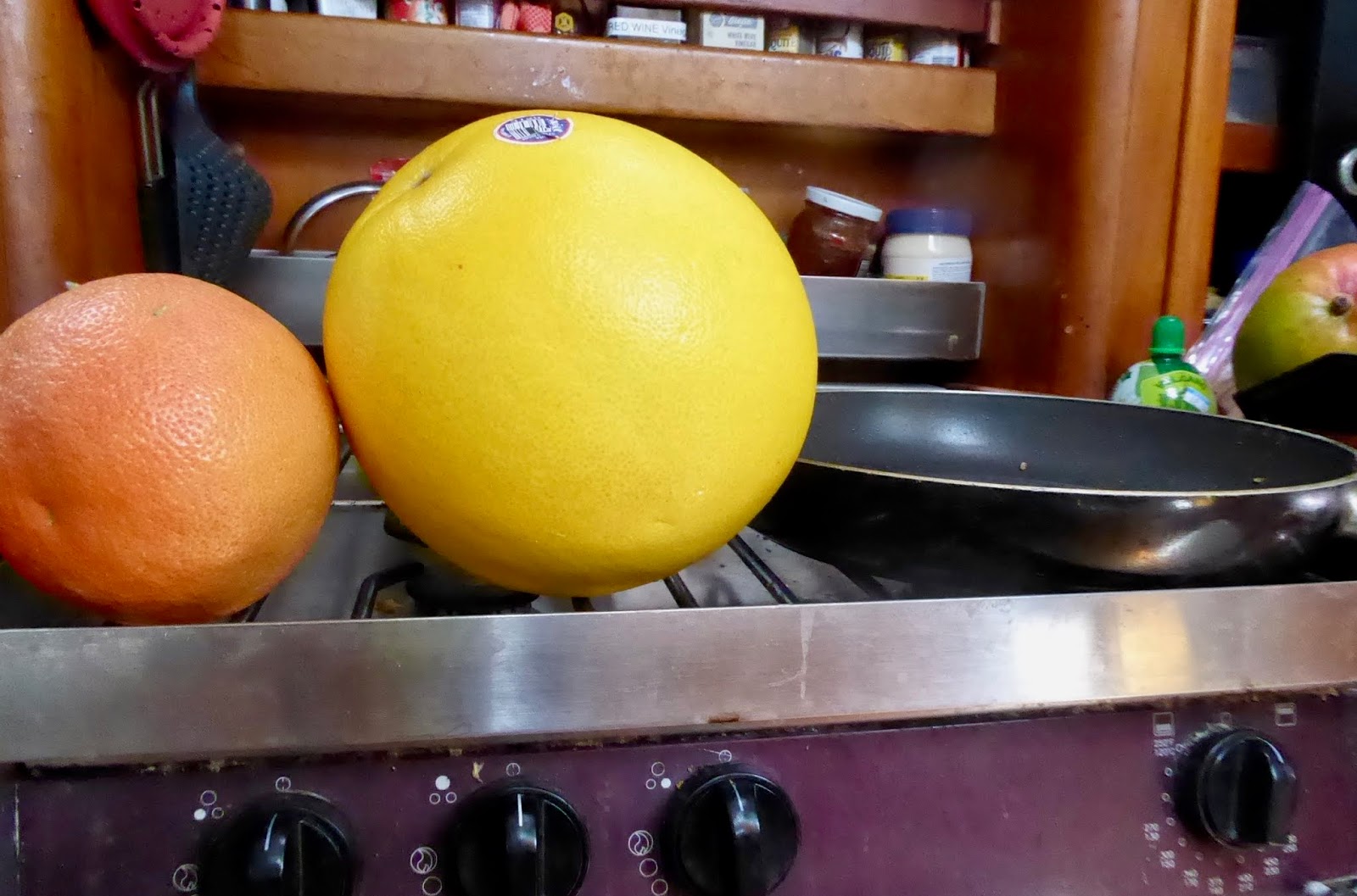
A favorite fruit, the giant Pomolo, 

No, I believe in following the rules on the water and on land. I’m not always happy to do it however. Take for example, our tedious and uncomfortable effort to clear out of the Turks and Caicos nine days ago.
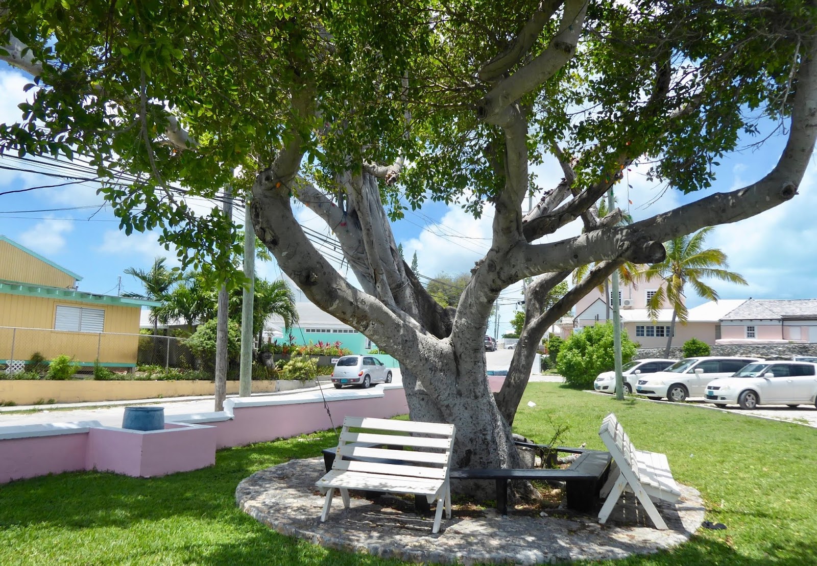
Georgetown park in front of Customs and Immigration

We crossed the Caicos Bank from east to west on a Friday, with the intent to clear out of the country on Saturday. We were tired from long sailing days and planned to spend the day snorkeling and relaxing after clearing out and then get right back to sailing on. 
Providenciales, in Turks & Caicos

9:00 AM We went ashore on the island of Providenciales, or Provo as it is commonly called, and beached our dinghy on a white sand beach. A man there offered to watch our dinghy, our concerns being theft and the possibility of it floating away when the tide came up.
Chalk Sound next to Police Dept

There are two places on the island of Provo to clear out with Customs & Immigration. One of them, a marina tucked into a shallow harbor has C & I on site 7 days/week. Unfortunately, the draft of our boat is too deep for that marina except at high tide. We were not about to waste 24 hours by waiting for a high tide to enter and for another to leave.
Road from beach to Freight Port, Provo

9:30 AM The other way to go through C & I is at the Freight Port, where the cargo ships come in. We learned after walking ourselves to the Port Office, that C & I would come in on the weekends only when a cargo ship comes in. (The cruising guide we consulted had said nothing about that.) A cargo ship was en route they said and “should be here by 11 or 12:00.” So, we strolled down the dusty road in a thumb-twiddling state.
Carl sitting in shade at Police station

Provo is a desert island. There are no shade trees. And scant few buildings in the area near the Port. It’s very hot. I regretted not drinking more water before leaving the boat. The only spot of shade two loiterers like ourselves could find was on the front step of the police department down the road. So, there we sat until thirst overtook us. So we trudged further along to a gas station/convenience store. 
EnR - Emergency & Rescue

A lone young woman was at the register. How long can a couple of tall, imposing characters like ourselves linger around inside a store ogling the refrigerated section and sidling up to the the air conditioning before starting to look like they’re “up to something” nefarious? Not long enough, let me tell you. Two cold beverages and a snack accompanied us back to our spot of shade on the step of the police department. 
Photographed birds while
waiting. This guy sings
his heart out

11:30 AM. Trodding back to the Port Office through that same inch of fine dust we’d stirred up earlier. “The ship should be here about 1:00 or after,” they said. Hmph. Out into the desert once more. This time we schlumped along until we found a bar/cafe that was open. The cafe actually had good food. We began to think that our luck was turning. It wouldn’t be long now and we’d be on our way.
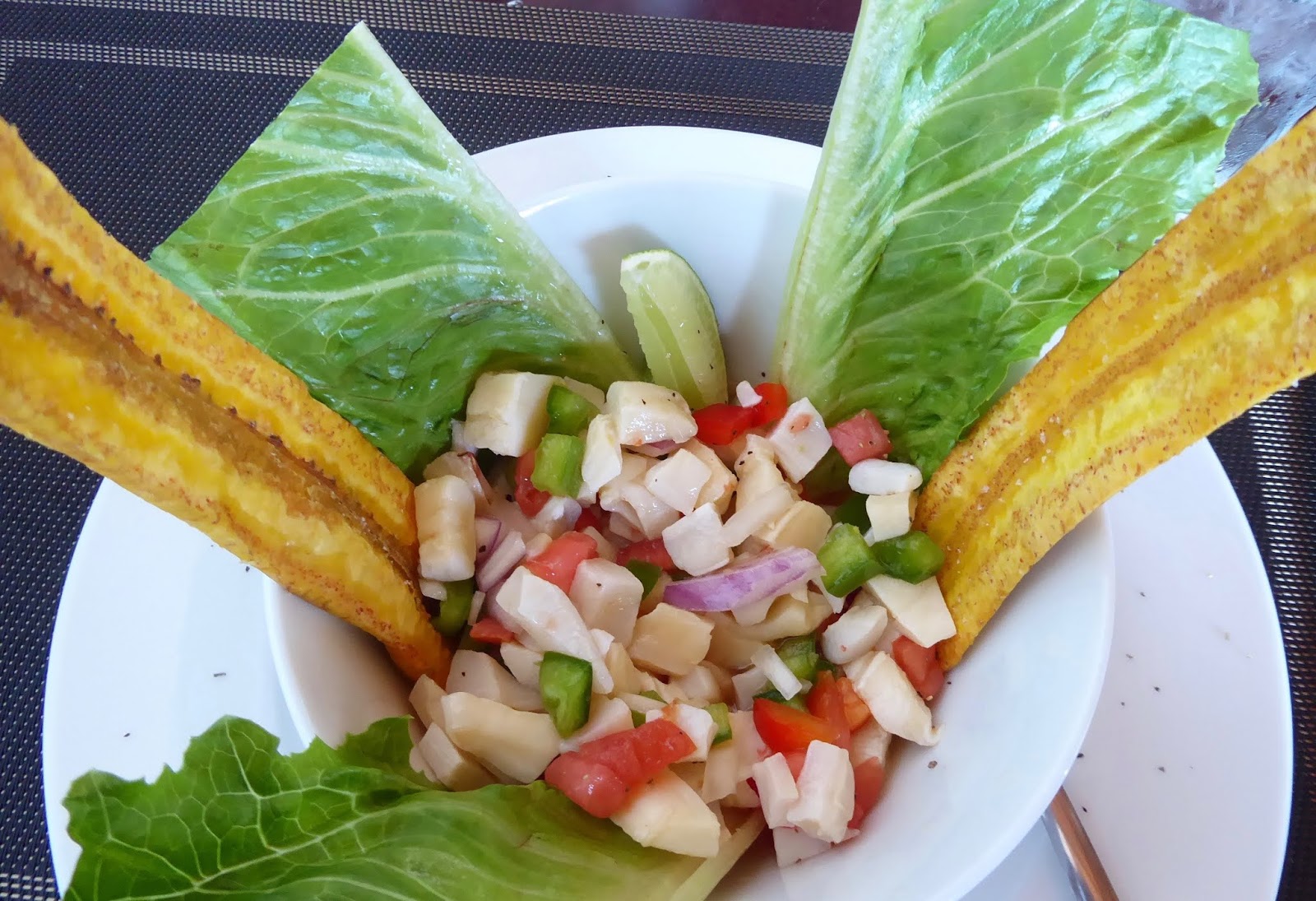
Lunch of cracked conch and plantain spears

1:00 PM. We slowly hauled ourselves back to the Port office. “Oh, the ship won’t be in for a couple of hours.” I may have groaned aloud. One of the nice young men in the office offered to call C & I to see whether they could be encouraged to come in before the ship arrived. No answer. That was the same result that we had had earlier in the morning when we tried calling.” So much for our luck changing. Now what to do. We’d already found and taken advantage of all the available air conditioned buildings open to us in the vicinity of the Port. 
a wee spot of shade by gated beach house

What to do…what to do….? Neither of us was energetic enough to make a decision. Maybe Carl could bring me back to the boat? We made it partway back to the beach toward our dinghy and then stopped under a wee spot of shade offered by some bougainvillea bushes. There was absolutely no purpose in going back out to the boat.  A half hour to get there and another half hour to return to the Port office? Where’s the sense in that?
The only true flowers on bougainvillea are
the tiny white ones surrounded by leaves
that turn many different colors.

We needed to do something with ourselves however. Something. The bushes were alongside a gated beach house and we stood there until we began to feel like lurkers, casing the joint. Anyway, there was no place to sit down anywhere. Carl’s foot was hurting…..a plantar fasciitis thing we think. What to do? What to do? “What do you wanna do?” “I don’t know. I don’t know what to do.” “What do you wanna do?” At least we were in complete agreement that we were individually and as a couple, completely useless in developing a plan. 

Scaling the hill
Then we noticed someone standing on top of the hill next to the beach…a rocky, cactus and prickly bush-covered hill. The hill lay between us and the Shipping Port. A potential shortcut, if you will, to the Port office. “We could climb the hill for something to do?” “Do you really want to climb a hill?” “No, but what should we do then?” “I don’t know.” “If we climb the hill we can see when the ship comes in. Plus, there’s probably a nice view from up there.” “I’m really hot.” ”There’d be more of a breeze up there.” “That’s true.” “So should we go?” “Ya, let’s go.” “Oh, look there’s a path over there.”
The freight ship we are waiting for--it'll be another 1 1/2 hours before it arrives.

I should mention that I was not wearing hiking shoes but rather slip-on sandals. And it was a very steep rocky hill. But now I risk sounding like a whiner. We skirted the sharpest cactus, found the most secure looking rocks and climbed to the top of the hill. Indeed, there was a nice breeze there. “And look, there are rocks we can sit on.” “And look out there; there’s the cargo ship out on the Caicos Bank.….faaaar away yet.” There we sat—the day slipping away. 
Down the other side of the hill. Freight yard below.

4:00 PM We watched the cargo ship approach the dock far below and we started down the other side of the hill to the Port Office hoping that C & I would be willing to clear us out before dealing with the cargo ship. Yes, they would. Excellent!  We were given hard hats and reflective vests to wear in the shipping yard. This was almost starting to be fun. I was trying to be more upbeat about the extremely hot, and wasted day. 
My first time wearing a hard hat. 

4:15 PM  In the C & I office. “We’re on a sailboat. We’d like to clear out of the country,” we said.  Two uniformed officers, a middle-aged man and a woman glanced at us, then looked at each other in what I would call a sheepish manner. Without saying a word to us and mumbling between themselves they rustled around the office. By that I mean, opening and closing file cabinet drawers, rifling through desk drawers, cabinets, moving things around on the counters. Earnest Rustling if I ever saw it. Finally, the man pulled out his cell phone. We could hear part of the conversation, “We’ve got a ….a pleasure sailboat; …..wanna clear out …….where is the……..looked everywhere.” Neither had ever worked in that office before, they said. Just filling in for the regular guy. I’d have never guessed.
Alternate route back to beach.

All told, it took less than 10 minutes to complete the clearing out process. We opted not to scale the steep shortcut over the rock and cactus covered hill. We were back on the boat again only 8 hours after we’d left it with our silly plan of clearing out early and sailing on.
Fortunately, our dinghy was rescued.

Incidentally, the man who had “looked after” our dinghy noticed it was gone about mid-day, and told us he had found it innocently floating further down the shore. He readily acquiesced to a tip for looking after the dinghy; after all, he’d had to go out looking for it. (As if the dinghy had been naughty and given him a run for his money by making a break for it?) 
Sisal plant. See 12-14' stalk rising
out of center of the cactus-like plant.
Sisal was a crop used to make rope.

Although we’ve heard several sailors report having had a fine time in Provo, I regret to say I didn’t much care for this island.


Thursday, April 25, 2019

A Ride-Along on the Atlantic


The time is 2020 (8:20 PM) and we are currently under sail at Lat N20 4.62’ and Long W70 0.37’. Or, Latitude  N 20 degrees 4 minutes and 62 seconds. (Now 63 seconds) and Longitude W 70 degrees 0 minutes and 37 seconds. (Now 38) You can see where the Lat and Long are going. 
Compass shows our heading,
as does chartplotter,
below right.

We are moving northwest (on a Heading of 320 degrees) toward the small island of South Caicos, to a place called Cockburn Harbor. It is one of the Customs and Immigration entry points into the Turks and Caicos. 
Top-time of day.
2nd-Apparent wind speed
3rd-GPS Heading
4th-GPS Speed
5th-Depth (blank here)
6th-GPS Position

We are sailing at a blistering speed of approximately 5.5 kts, or 6.3 mph. You might be able to run faster. We left at 0600 this morning and have calculated that the passage will take us about 36 hours. We hope to arrive before nightfall tomorrow.  Entering an unknown harbor in the dark is not a wise thing to do. Whenever possible, we attempt to err on the side of wise.
These islands are all the Turks & Caicos,
part of the UK

First off, to those who earlier praised my writing skills, I apologize. My recent post about lost and found words was dull and trite. Secondly, to those who suggested that I might consider teaching geography, I chuckle heartily and hope you will join me in doing so when you learn the following.
When seas are calm, I
can work outside on
cockpit table

I was in error when describing the Bahamas in an earlier post, which I now want to correct. I stated with certainty that the Turks and Caicos are part of the Bahamas. Not true. At one time they were all part of the Bahamas Colony of the UK, but in 1848 they gave up trying to unite all the islands. 
Explains Q Flag and Bahamas
and Turks & Caicos flags

The Turks and Caicos Islands remain a part of the United Kingdom while the remainder of the islands are Bahamian. Maybe this seems like an insignificant geopolitical point, but I’m sure that to the people of the Turks and Caicos it is not. So, when we arrive in Cockburn Harbor, we will be flying our Q flag (bright yellow quarantine flag) until cleared in and then the flag of the UK, not the Bahamas flag. 
A comfy spot in cockpit at night. The picture
looks red because we use red headlamps at
night to prevent interference with
our night vision.

Since the night stretches out before me with little wind and not much to do in the way of active sailing, I thought I would share something of what is going on in the cockpit of the sailboat. Inotherwords, if you were sitting here with me, what are the things you would/might be paying attention to as we sail along. 
This is what you would see facing forward
standing behind the wheel. Chartplotter
on right. Autopilot on left.  Wheel below.
You can see the sails through the window.

To other sailors, this post will also be somewhat dull and trite. However, I have a lot of friends and family that have never sailed (some that would rather die than step onto a sailboat) and I feel a certain responsibility to fill in some of the gaps about sailing and perhaps dispel some fears. Or, potentially create new ones.  We’ll see.
When you look down you would see the
wheel (helm) and compass. There's a
seat for you at the helm if you like.

The trade winds are mellow for the next 24 hours or more and they’re at our back. Mellow, but fairly consistent at around 12 knots. That’s just enough energy to keep us moving at that 5.5 knots that I mentioned. If the wind should die, we’ll turn on the engine to maintain a speed between 5 and 6 knots. We need to arrive in daylight after all. 

Many ways to look at
weather  forecasts. These
are only some of them.
Because the wind is behind us, this is a downwind sail. We are using only one sail, that being the genoa, the larger of the two headsails that attach to the top of our mast and extend to our bow. (Bow= pointy end of the boat.) We have it *sheeted loosely, so that it forms a big scoop to catch as much wind as possible to push us forward. 
This is a photo of mains'l, but it
is intended to show how you can
look at the sails in the dark.
Headlamp, or flashlight.

*On a sailboat, the sheets are the lines that are attached to the sail that we pull tight or loosen from the cockpit to control the sails’ shape. There are no ropes on a sailboat. None. All of the lines have other names which are important to know but for your ride-along this evening, you can let that slide. 

Several lines run through
chocks to lock them. The
sheets are wrapped around
winches. 

Why do we have only one sail up? The mains’l remains tucked in its resting place atop the boom because if we were to raise it, it would block the wind from reaching the genoa and then our genoa would be flopping back and forth. So, we adjust the sheets from the cockpit to get the most that we can out of that one sail and leave it at that. Nothing fancy about this evening’s sail.
The video has two sails up, but I wanted to
show you what the ocean is like when it's
fairly calm.

How do we know where to go? We find our destination or a waypoint shy of the destination and set a course toward it by setting the auto-pilot to steer the boat in that direction. Given that we’re in deep water and there is nothing out here to run into, this is a simple matter. An auto-pilot can steer in heavy seas better than we could. It’s a unit that is connected to the rudder and tells it how to steer. Ingenious.
Alternate topographical display on the
chartplotter 

The moon hasn’t risen yet and it’s black like velvet.  Of course, there is nothing to see except for the water around us. If we saw lights on the horizon, we would have to put some thought into figuring out how far away the vessel was and where it was heading so as to avoid a collision. We have tools to help us with that and it’s astonishingly easy to do. Chart plotters are amazing. 
Chartplotter display showing our boat, our
path behind us and direction we're headed.
Ocean depths are the tiny numbers.

I have checked the chart plotter out to a distance of about 40 miles. There are no boats anywhere around.  At least, none that are broadcasting their position by AIS ( Automatic Identification System) and this far out on the ocean, most boats are going to be broadcasting as well as receiving data from other boats that are transmitting their location, heading and speed. 
While not on watch, we can sleep. The dark
cloth is a lee cloth It's tied to prevent the
sleeper from rolling off the settee.

In spite of that relative margin of safety, we cannot just all go to sleep and let the boat do its’ thing. It is theoretically possible that a fast moving boat could intersect with us in 20 to 30 minutes so you and I are on watch for the next three hours. We have chosen 3 hour watches for our passages. It’s an arbitrary period of time.
GPS position also shown
upper left part of screen.

Back to the chart plotter.  It not only shows us the location, heading and speed of other boats but also shows our own *GPS location (our Lat and Long), our GPS heading, our GPS speed, and even the depth of the water beneath us. Tonight, the depth meter has shut itself off when the distance to the ocean floor dramatically increased. 
Other boat instru-
ments. Top, last
recorded depth.
Below-water temp
82.3 degrees

The last reported depth was 54 feet. It will turn on again when the ocean floor rises up to meet us. At that time it will be our job to avoid running into that ocean floor, which will have become an island or at the very least, a rock. But we’re a long way from any land and so we won’t worry about that tonight. 
Look behind you to see the dinghy
riding several feet above the water.  

If you’re interested, the chart plotter map face or a paper map can show you the reported depths of the ocean floor based upon readings taken at some time over the last three centuries and that now inform the makers of the maps, etc. The map says that the ocean depth here is 14,580 ft. About 2 1/2 miles deep. Cool.
We use paper maps, too.

So, things are going swimmingly here, don’t you think? Our 3 hour watch will soon be over and we can go to bed. Until then, some chamomile tea? It’s been a quite pleasant evening out here on the Atlantic, has it not?
We are heading to a location on the upper
right side of the Caicos Bank. (paper map)