 |
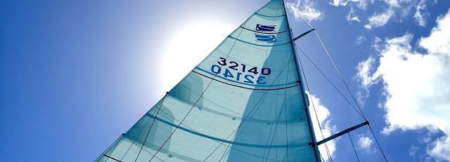
| Northern Star sail with identifying number |
 |
| A chart plotter course at night |
And we fully intend to end up here-> Lat: N17*00.729’ and Long: W061*46.292’
 |
| Dennis Johnson on left. Carl on right. |
 Now may I distract you with a few well-placed photographs--merely a few moments of dilly dallying while the map aficionados check the Lat and Long. (There are only so many ways to build up suspense in the context of a brief blog post. I’m doing my best.)
So, these are photos from our visit to friends and their dogs in Wilmington, NC before Hurricane Irma.
 |
| Carl and I at Atlantic Beach with Leschishins |
Here we are with friends from Duluth, having brunch in New Bern, just up the road from our boat in Oriental.
Here we are again with friends at the ocean, in Atlantic Beach, NC.
while hiking
Goose Creek State Park, NC.
And here we are racing in the Oriental Cup race which was last Saturday! We raced on a boat called Quixotic and we all benefited from the racing experience of the elderly gentleman (mid to late -80's) in the green shirt.
Goose Creek State Park, NC.
And here we are racing in the Oriental Cup race which was last Saturday! We raced on a boat called Quixotic and we all benefited from the racing experience of the elderly gentleman (mid to late -80's) in the green shirt.
 |
| Raced on Quixotic in the Oriental Cup. Carl & I were rail-meat at this point. |
And now for the plan. In about three weeks, we will be moving our boat from Oriental, NC where we’ve had quite a pleasant summer, up to Hampton, Virginia. Going north as the days get colder? Yes. But only until on or around November 2nd.
Hampton is the site of the start of the Salty Dawg Rally, an annual event of some 50-80 sailboats (maybe a few big trawlers) that will sail from there to the Caribbean.
 |
| Harbor of Hampton, Virginia |
Prior to Hurricane Irma, the Salty Dawg Rally was scheduled to sail to the British Virgin Islands. Irma brought that plan to a screeching halt. The BVI’s, as we all know, were devastated by the largest hurricane that the Caribbean has ever experienced and that the U.S. has ever seen. For some days after Irma, we didn’t know if the Rally would take place at all. Was there an island along the northern perimeter of the Caribbean that could withstand the onslaught of 50-80 cruising sailboats?
 |
| Sunrise on the Atlantic |
At first we talked about sailing to the BVI’s to offer our help there. We thought we could help by bringing supplies with us to the islands. We could help repair buildings, or whatever was asked of us, given our limited experience with building structures, anyhow. Then we realized that we would become a burden to the islands rather than a help. We could only carry so many supplies beyond what we need for ourselves, and if we developed boat problems in the crossing, there would be no functioning infrastructure there to help us out.
 |
| Early morning south of New York harbor |
Better for the onslaught of small sailboats to stay away from the BVI’s as they initially organize and rebuild and take our tourism dollars in the short term with us to islands that would be able to handle visitors. From there we can move on to the more southerly islands of the Caribbean.
 |
| Nearing sunset on Atlantic Ocean |
 |
| Night sail on Atlantic |
By going directly to Antigua, we will be bypassing all of the Bahamas, Cuba, the Dominican Republic, Puerto Rico, the American Virgin Islands, the British Virgins and the northern Leewards, all of which saw more hurricane action than the more the southern Leeward Islands of the Caribbean. In addition to Barbuda (which we are bypassing) and Antigua, the remaining Leeward Islands include Guadeloupe and Dominica.
 |
| Sailing under a brisk wind, ~25 knots |
South of the Leewards begins the Windward Islands: Martinique, St. Lucia, St. Vincent and the Grenadines, and all the way south to Grenada, off the northern coast of Venezuela. (We shall not be venturing anywhere near Venezuela.) Heading west from Grenada there are the islands known as the A B C’s. Why? Because it is easier to remember than the Aruba, Bonaire and Curacao Islands. From the western shore of Aruba, it is a mere 75 nautical miles to the coast of Colombia, South America!
 |
| Late afternoon on the Atlantic |
Now, back to those words above— “~next two years.” Once in the Caribbean, we anticipate that Northern Star will not be returning to the U.S. for a while. To ride out the hurricane season of 2018, we will take the boat south of the hurricane zone, ie. Grenada. We do expect to come back to the States during the next two years, but by air rather than by sailboat. By sail, it would take months to work our way back north to the U.S.
 |
| Approaching Bahamas last winter |
There is so much more to tell you about—the Salty Dawg Rally, boat preparations, our crew and other important decisions we’ve made, but that will have to wait for another post. For the next few weeks we are still in Oriental. More to follow.


No comments:
Post a Comment